

Teleglobal IoT
Design, implementation, and management of IoT systems for advanced applications such as fire protection projects, energy optimization, and Smart Cities.
Main
Applications
Fire Detection & Prevention Solutions
Installation of sensors and cameras in targeted areas for the early detection of wildfires.
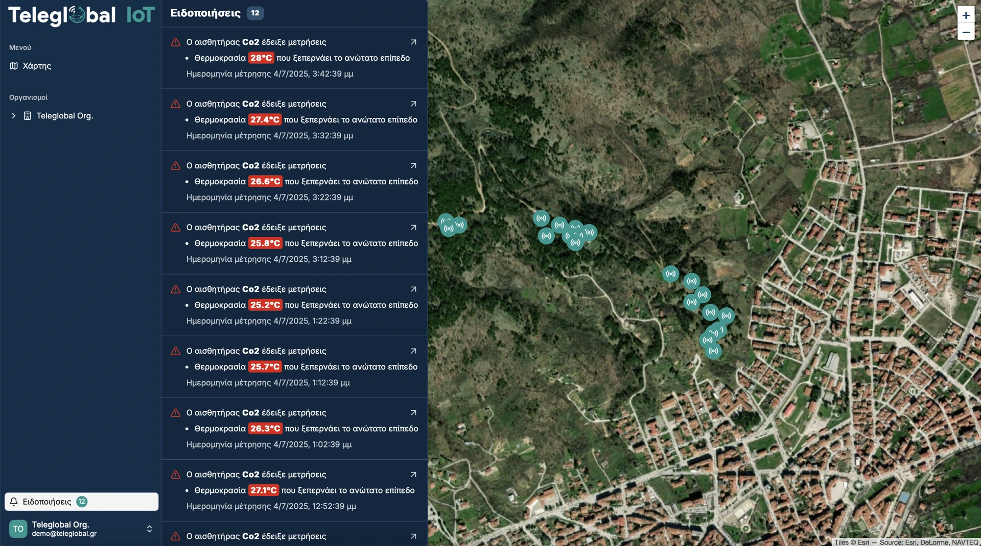
Using real-time data collected from the sensors, the system sends alerts via push notifications and SMS messages.
Energy Efficiency Solutions
(school facilities, public buildings, hospitality properties)
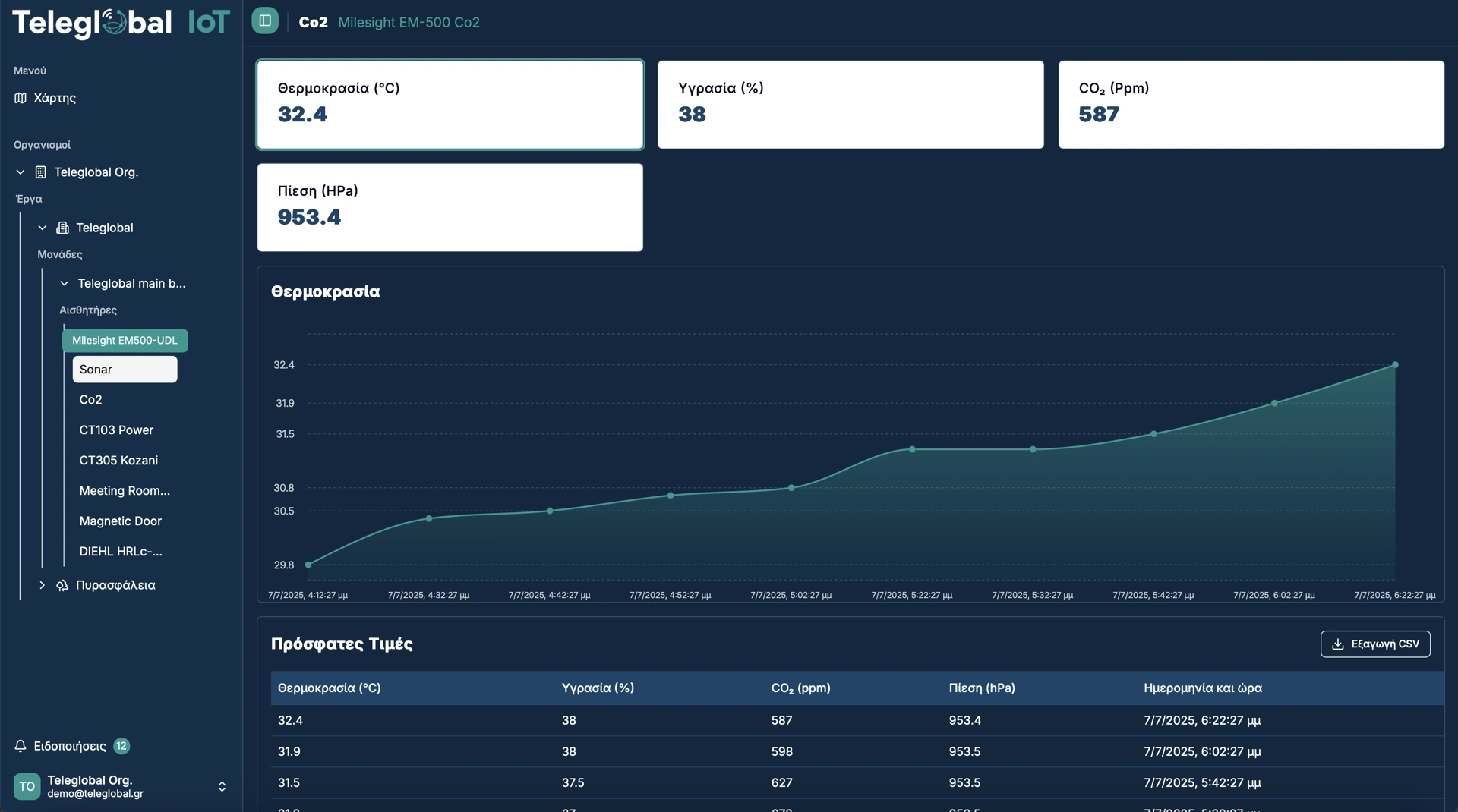
By leveraging sensor technologies and real-time data, we enable remote monitoring and management of utility
and energy consumption (oil, electricity, water), improving efficiency and operational control.
Smart Hospitality Solutions
Remote management and energy optimization of hospitality properties, delivering added value to both guests and owners.
Smart Cities
Innovative smart city technologies focused on efficiency, sustainability, and better public services.
Industrial IoT Solutions
(livestock, agricultural operations, water and oil storage)
Environmental condition monitoring, predictive weather insights, and real-time measurement of liquid levels and usage.
Our Services
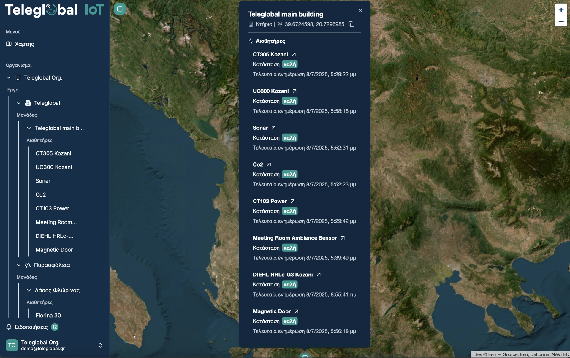
Design, supply, installation, management, and maintenance of sensor networks.
Provision of a web application for network management and monitoring.
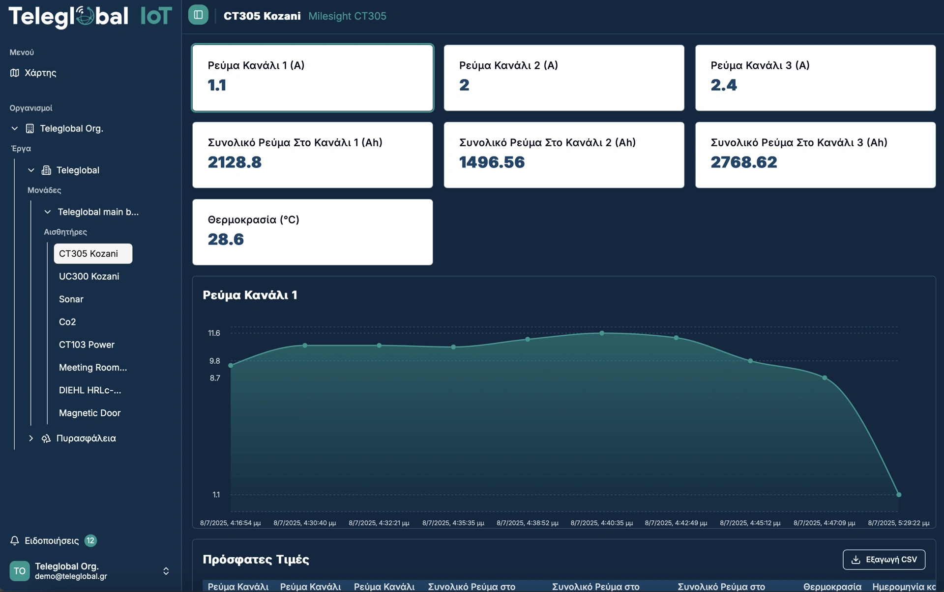
Real time data
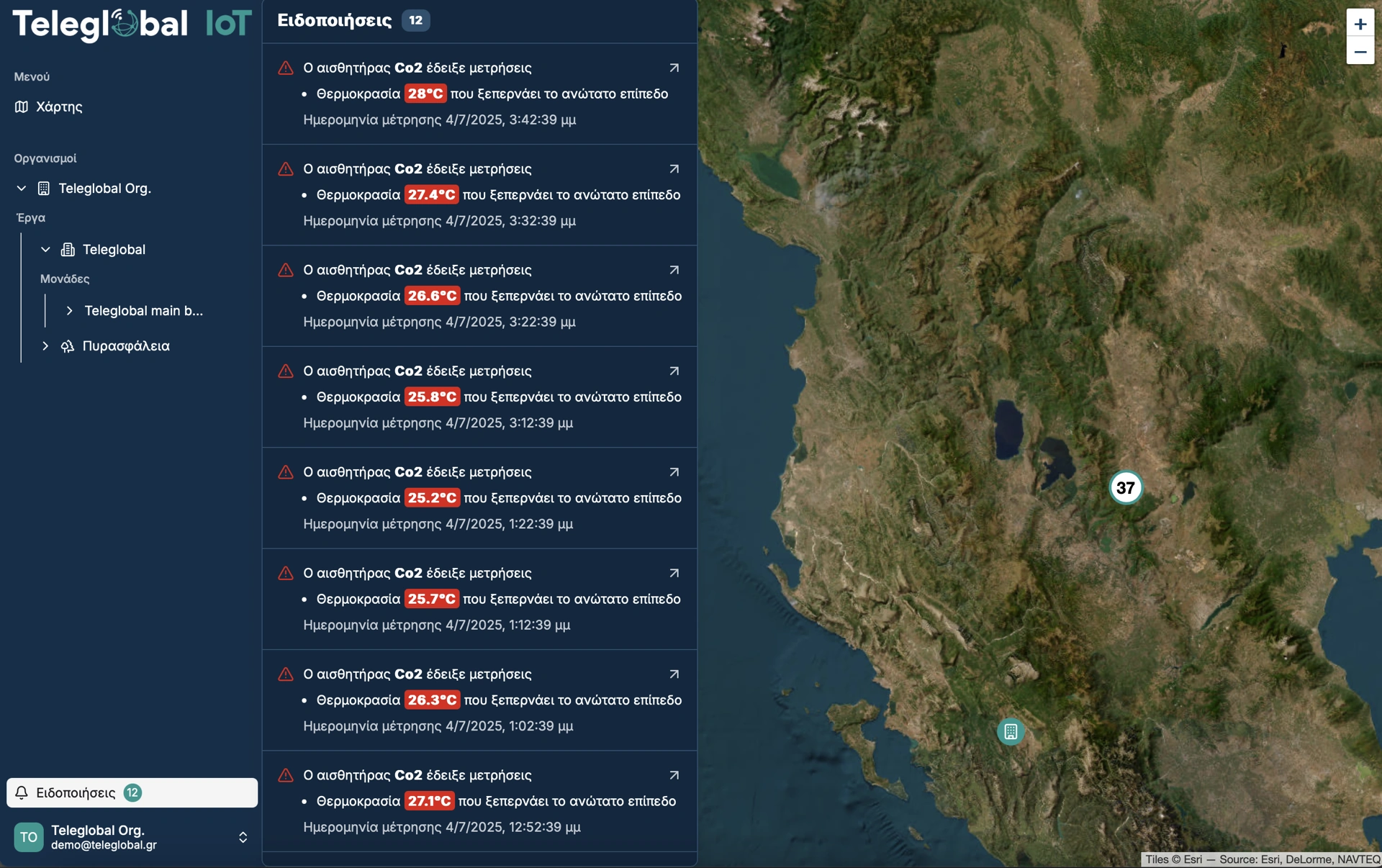
Instant notifications when predefined limits are exceeded.
Why Work With Us
Why Work
With Us
- Fully customizable application
- Integration of sensors, cameras, and Wi-Fi technologies
- Lorawan and WiFi


Selected Projects
Selected
Projects
OFIDIA 1 – (2007–2013): The OFIDIA (Operational Fire Danger Prevention Platform) project was launched as a cross-border cooperation initiative between Greece and Italy under the Interreg Greece–Italy 2007–2013 program. Its objective was to enhance the prevention and management of forest fires through the deployment of advanced technological solutions for monitoring, risk analysis, and rapid response.
Implementation in Epirus:
- Installation of high-definition (HD) cameras at selected forest monitoring locations.
- Deployment of meteorological stations and additional environmental sensors for continuous data collection.
- Establishment of a control room in Epirus for real-time monitoring.
- Development of GIS software and risk mapping to support local authorities (Fire Service, Civil Protection).
OFIDIA 2 – (2018–2021): The second phase, OFIDIA 2, strengthened and expanded the infrastructure of the initial project by integrating more advanced technologies and encouraging greater engagement with local communities. The project was funded by the Interreg V-A Greece–Italy 2014–2020 program, aiming to develop a comprehensive cross-border wildfire prevention system.
Actions in Epirus:
- Installation of 12 new HD cameras in forest areas for live monitoring.
- Deployment of 6 new meteorological stations to collect and analyze critical weather data for fire risk assessment.
- Acquisition of drones for surveillance of remote areas, enabling real-time image transmission to the control center.
- Support of local Civil Protection services through vehicles and technical assistance for infrastructure maintenance.
- Training and awareness programs for students and local communities, promoting prevention and early wildfire reporting.
- Development of a risk forecasting system using big data and algorithms, integrated into regional operational structures.
Key Benefits
- Establishment of a wildfire risk monitoring network in Epirus, based on both ground and aerial data sources.
- Improved readiness of local authorities (Fire Service, Civil Protection) for early detection and response.
- Enhanced collaboration between public services and local communities, contributing to reduced wildfire impact.
SOLVE: The SOLVE project (acronym: Cross-Border Complex Floods and Forest Fires Prevention and Management) is a cross-border initiative between Greece and North Macedonia under the Interreg IPA CBC 2014–2020 program. The project commenced on 10 December 2021.
Objectives:
- Prevention and management of forest fires, including Wildland–Urban Interface (WUI) scenarios.
- Mitigation and response to flood events (urban and flash floods).
- Development and equipping of operational teams, implementation of an early warning system, joint exercises, training for professionals and local communities, and active citizen engagement through participatory GIS.
- Supply and installation of modern equipment for first responders, firefighting units, and Civil Protection services.
- Training programs for professionals, volunteers, and journalists, including joint sessions and workshops.
- Large-scale joint exercises with firefighting and Civil Protection authorities, evaluated in real time.
- Participatory GIS system: awareness campaigns and active citizen involvement in risk reporting and mapping.
- Support for scientific research on wildfire and flood risks, based on research data and methodologies.
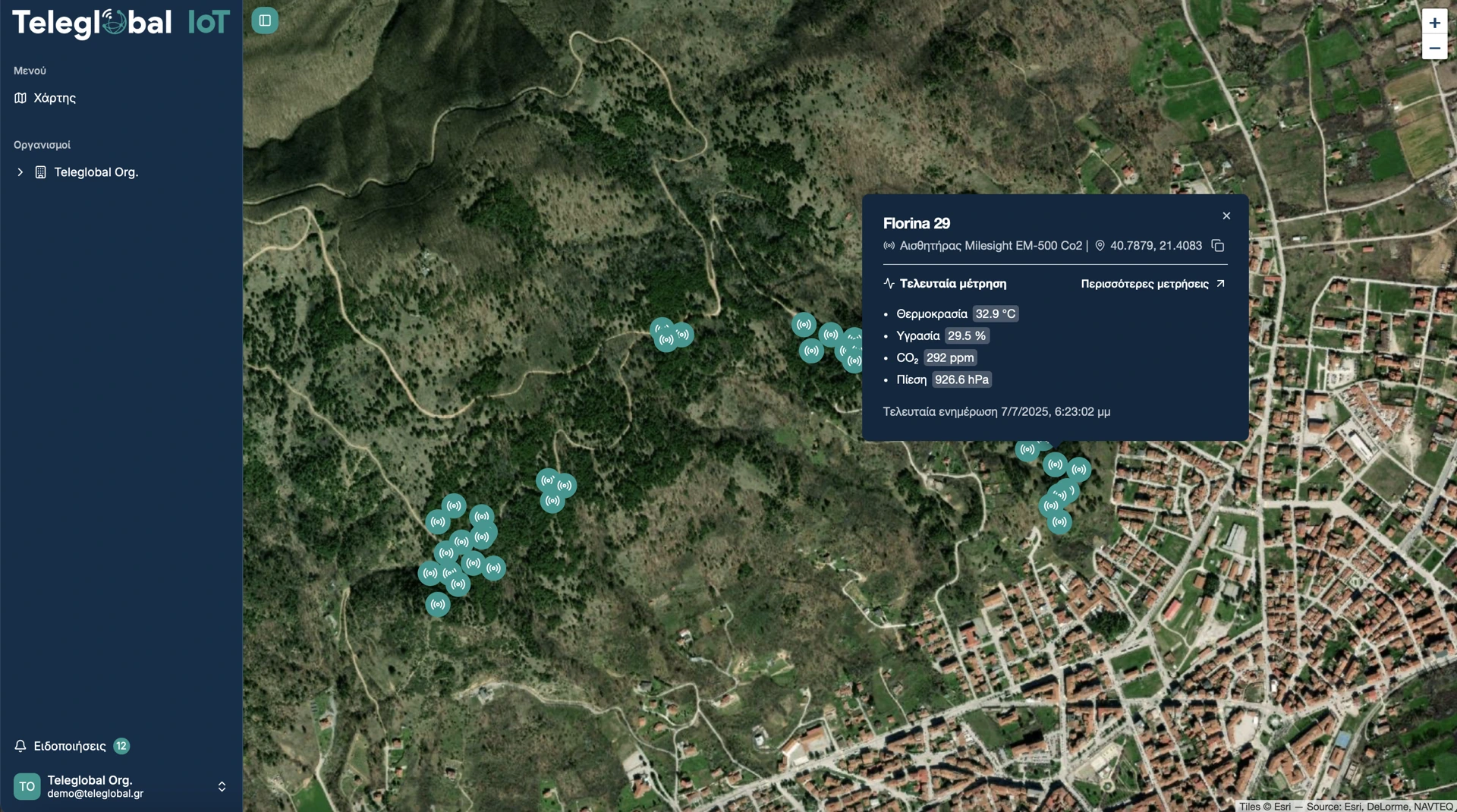
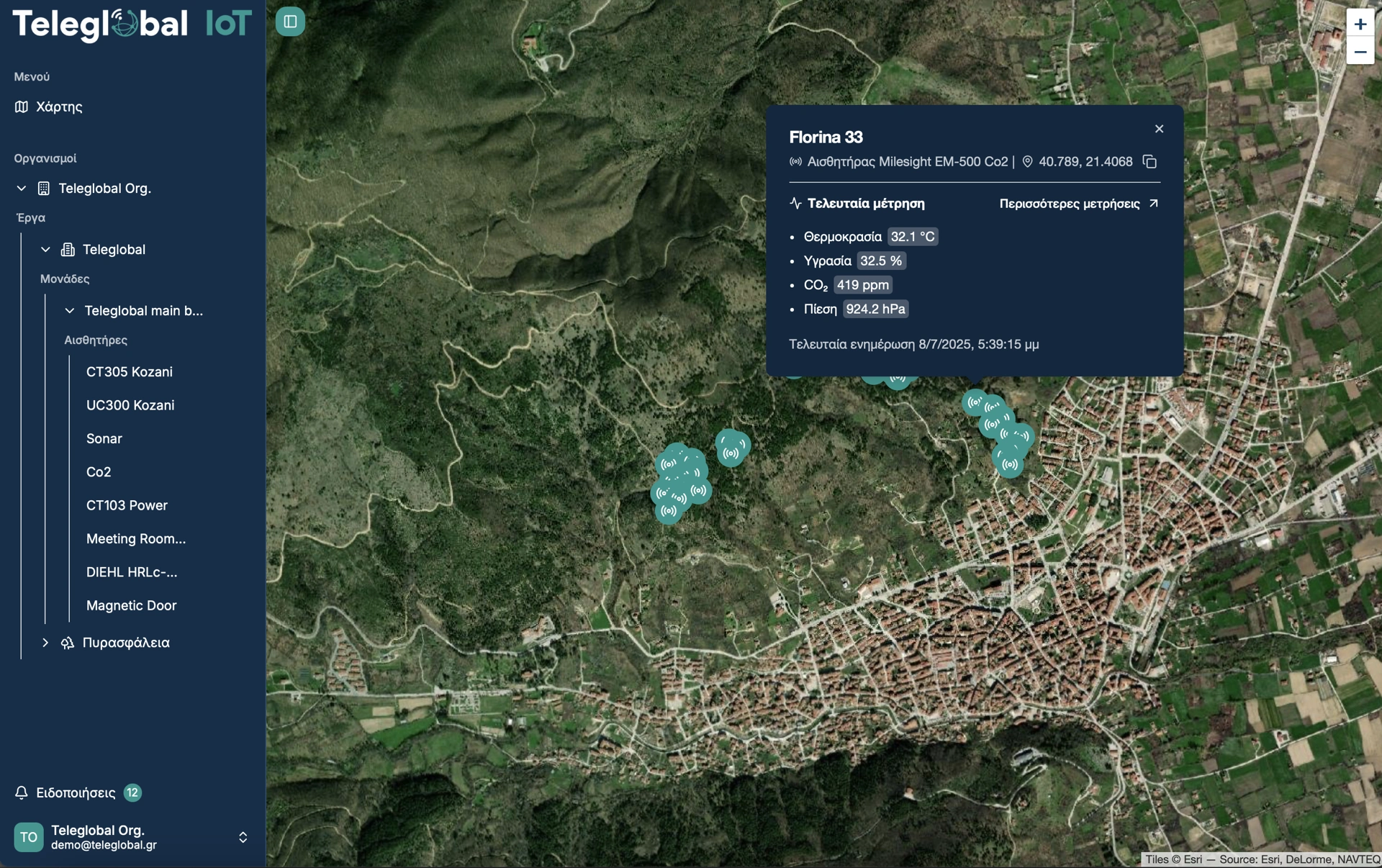
The SOLVE program strengthens cross-border cooperation in natural disaster management, with a particular focus on Florina. Through equipment upgrades, training, joint operational exercises, and participatory GIS tools, it establishes an effective rapid-response framework for wildfire and flood incidents — a model that can be replicated in other regions.
We evaluate your operational needs and deliver tailored IoT solutions.